


Britain is about to turn unseasonably ‘autumnal’ with Polar winds to make it “cold enough for ice”.
Last week’s mini heatwave will feel like a distant memory as temperatures in remote spots plunge to single figures.
Arctic air could see some regions waking to patches of ice, almost unheard of during mid-summer.
Jim Dale, meteorologist for British Weather Services and social commentator, said: “This week is going to turn much cooler in Scotland and northern Britain, and that is going to be the thing that people notice the most after the recent spell of hot weather.
“It may even be cold enough in some of the glens and Highlands of Scotland to get some ice patches, so we are talking about weather for gloves as we go into a returning Polar maritime airflow.
“It is also going to be windy across Scotland with the chance of rain, and everywhere will turn more unsettled.”
Thermometers will struggle to get much above 5C in the north with southern regions lifting to around 21C.
A shabby outlook awaits for at least the next week at least as summer slouches past its lacklustre mid-point.
Mr Dale said: “The best of the temperatures will be in the south where we could see 20C or 21C through the week but that is going to be the best of it.
“That said, where there is sunshine and it is dry, it is going to feel pleasant.”
A north-south split through the start of the week will bring the most unsettled conditions to the north of the country.
The weather will take a dive on Tuesday evening, with Scotland on alert for heavy downpours.
LATEST DEVELOPMENTS:
Met Office meteorologist Alex Burkill said: “Through Tuesday evening, we are going to see a bit of a north-south split.
“Across northern areas there will be outbreaks of rain with some of them a little bit on the heavy side.
“Towards the south, though, it is staying mostly dry and there will be some late sunshine.”
Rai will become more widespread ahead of the weekend with temperatures sinking below par for July, he warned.
He said: “As we go through the rest of the week. there is more changeable weather to come, western parts will see the heaviest and more frequent rain and there will be some blustery winds around at times and temperatures are going to be around or a little bit below average for the time of year.”
Temperatures are set to drop on July 4
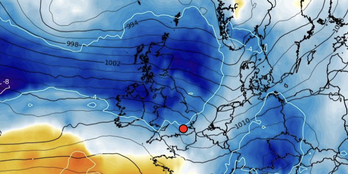
WX charts
The influence of low pressure will drive the change from sunshine and blue skies to chilly winds and rain.
High pressure, the harbinger of summer joy, will beat a retreat leaving the UK feeling unseasonably “autumnal”.
James Madden, forecaster for Exacta Weather, said: “Low pressure will impact the weather through the week, and this is going to bring cooler and windier conditions.
“Northern Britain and Scotland will take the brunt of this, and from Thursday it could turn stormy or feel quite autumnal with some moderate to strong winds at times.
“Many other parts will see some quite cloudy and breezy weather at times, although there will be some warmer periods in places when the sun creeps through.”


